Emporion, Emporiae (Ampurias) (Greek: ᾽Εμπόριον, “port of trade”): Graeco-Roman settlement in northeastern Spain, modern Ampurias.

According to the Greek geographer Strabo of Amasia, the Palaiapolis of Emporion was founded by Greeks from Massilia (Geography, 3.4.8). It was not a completely new town: the Iberian tribe of the Indigetes was already living there. The two nations appear to have gone along well: the natives obtained precious goods from the east, while the Greeks gained a stopover port in their expanding network in the western part of the Mediterranean.
History
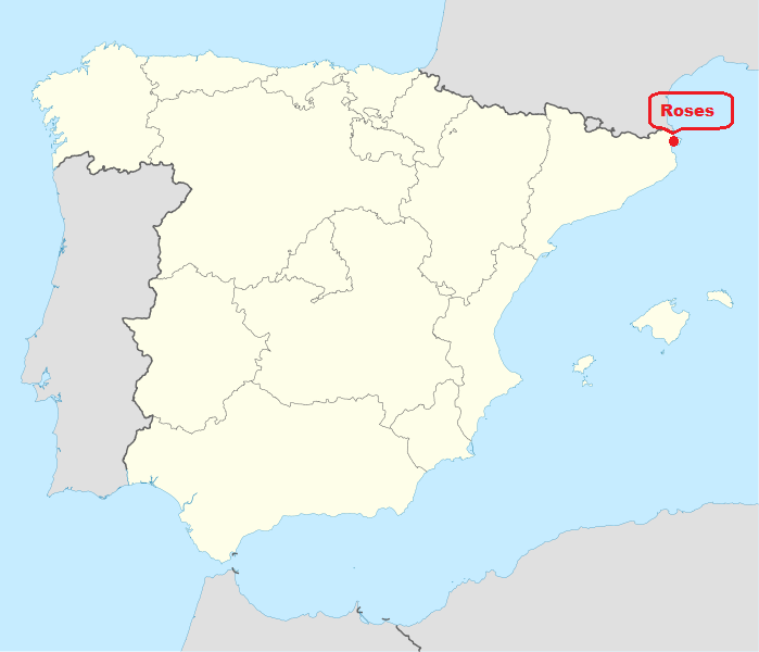
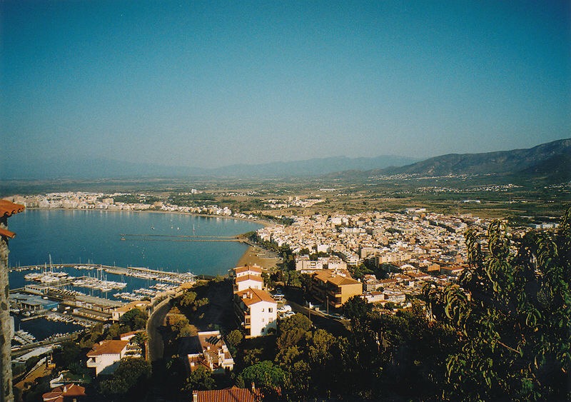
A Greek trading settlement inhabited by the Phokaians from Massalia, at the end of the Gulf of Rosas on the Costa Brava; it is 3 km from the village of La Escala and 40 km NE of Gerona. It is first mentioned in the Periplus of the Pseudo-Skylax and in Skymnos. Its location has been known from the time of the Renaissance since it gave its name to an entire district, the Ampurdan, was an episcopal see in the Middle Ages, and one of the counties of the Marca Hispanica.
The Greeks originally occupied the small islet of San Martin, now joined to the mainland, which was subsequently known as Palaiapolis (Strab. 3.4.8). They soon spread to the nearby coast and used the mouth of the Clodianus (Fluvia) as a trading port. The town was founded a little after 600 B.C. (date of the foundation of Massalia) and throughout the 6th c. was a mere trading settlement, a port of call on the trade route from Massalia (Marseille), two days’ and one night’s sail distant (Pseudo-Skylax 3), to Mainake and the other Phokaian foundations in S Iberia which traded with Tartessos. Because it was frankly a mart the Greek settlement grew rapidly, and probably received fugitives from the destruction of Phokaia by the Persians (540) and after the Battle of Alalia (537), also Greeks from Mainake and other cities in the S destroyed by the Carthaginians.
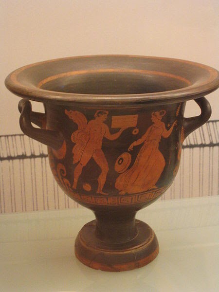
Greek vessel
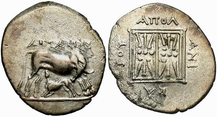
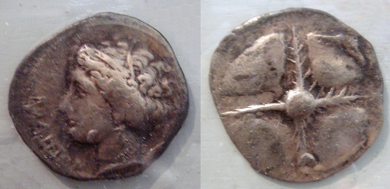
In the 5th c. Massalia declined, and Emporion, which was already independent, became a polis ruled by magistrates; it developed a brisk trade with the Greek towns in S Italy, the Carthaginian towns, and the native settlements in the interior, on which it had a profound Hellenic influence. Emporion then minted its own coins, first imitating those of the towns with which it traded, including Athens and Syracuse, and later creating its own currency in fractions of the drachma. The types were copied from those of both Carthage and Syracuse, and the currency system continued to be separate from that of Massalia until Emporion was Romanized in the 2d c. The 5th-3d c. were those of its greatest wealth and splendor.
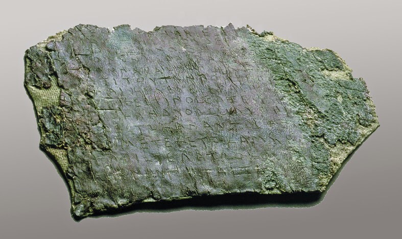
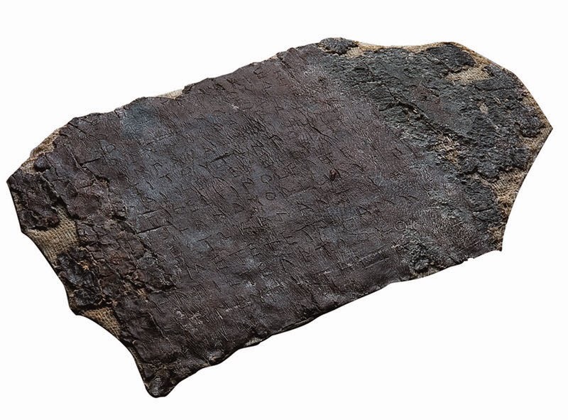
Business Letter (Greek inscription)
Commercial letter, written in Greek on plated lead, in which a merchant from Ionia sends off several orders to his representative in Emporion. Fifth century BCE.
[‒ ‒ ‒]ν̣[‒ ‒ ‒]?
[‒ ‒ ‒][κελεύε̄] ο̣[κ]ω̣ς ἐν Σαιγάνθηι ἔσηι, κἂν [‒ ‒ ‒] 1
[‒ ‒ ‒] Ἐ̣μππορίταισιν οὐδ’ ἐπιβα̣[‒ ‒ ‒]
[‒ ‒ ‒]νε̣ς ἢ ἔ̣κοσι κοἶνος {καὶ οἶνος} οὐκ ελ̣σω̣[….]δ[‒ ‒ ‒]
[‒ ‒ ‒]ἐν Σαιγ]άνθηι ὀνωνῆσθαι Βασπεδ[…]π[λοῖον ‒ ‒ ‒]
[‒ ‒ ‒]αναρσαν παρακομίσε̄ν κἂς [..]ε[……]ο̣[‒ ‒ ‒] 5
[‒ ‒ ‒]λ..εωνι τί τούτων ποητέον [..]ν[‒ ‒ ‒]
[‒ ‒ ‒]τα καὶ κελεύε̄ σε Βασπεδ[..]εδ̣ε̣ι[‒ ‒ ‒]
[‒ ‒ ‒ ἔρε]σθαι ε̣ τίς ἐστιν ὂς ἔλξει ἐς δ[.]οστ. α[‒ ‒ ‒]
[‒ ‒ ‒ ἠ]μέτερον· κἂν δύο ὤισι, δύο προ̣[εσ]θ[ω ‒ ‒ ‒]
[‒ ‒ ‒]ἀ̣ρ[χ]ὸς δ’ ἔστω· κἂν αὐτὸς θέλ[ηι ‒ ‒ ‒] 10
[‒ ‒ ‒ τὤ]μ[υ]συ μετεχέτω· κἂμ μὴ ὀ[μο]ν̣[οηι ‒ ‒ ‒]
[‒ ‒ ‒]τ̣ω κἀπιστε̄λάτω ὀκόσο̄ ἂν[‒ ‒ ‒]
[‒ ‒ ‒]ν ὠς ἂν δύνηται τάχιστα[‒ ‒ ‒]
[‒ ‒ ‒κεκ]έλευκα· χαῖρε.
1(δεῖ σε ἐπιμελε̄́σθαι)] ο̣[κ]ω̣ς: ὅπως / ὤς ZPE 72: ῳς … καν Slings: δεῖ σε επιμελέσθαι] ὄ[κ]ως ἐν Efenterre-Ruzé: <Ζ>α<κ>άθηι Musso: ὂ[κ]ως ZPE 68. 2 ἐ]ππορίταισιν (= μέτοικοι) / Ἐ]ππορίταισιν / ἀ]ππορίταισιν (= ἀμφορίτης) Musso: ἐπιβα̣[ίνηις ZPE 84: ἐπιβα̣[ίνε̅ν ZPE 72: ἐπιβα̣[ταισι ZPE 68 ZPE 72: ἐπιβα̣ Slings: ἐπιβά̣[ταισιν] Efenterre-Ruzé. 3 ἐ̣σ̣[…]δ[ Slings: πλέο]νε̣ς Efenterre-Ruzé: ἐλάσσο]νε̣ς ZPE 80: πλεο]νε̣ς … οὐκ ἐς θ̣…δ[…ZPE 72: ἐ̣λ̣ά̣[σσων ἤ]δ[έκα ZPE 80. 4 (φορτίον τό ἐν / φορτηγέσιον); Σαιγ]άνθηι ZPE 72: ]αν θήϊον ωνῆσθαι βὰς πέδ[ον καρ]π[ητανῶν Musso: [–Σαιγ]άνθηι ὀνῳνῆσθαι Slings: φορτίον τὸ ἐν Σαιγ]άνθηι ὄν Efenterre-Ruzé: Σαιγ]άνθηι ὂν ὠνῆσθαι (φορτίον τὸ ἐν) ZPE 68: Σαιγ]άνθηι ὂν, ὠνῆσθαι ZPE 72: Σαιγ]ανθηῖον ὠνῆσθαι ZPE 80. 5 ]αν ἄρσαν ZPE 72: ἄναρσαν ZPE 72: αν ἄρσαν παρακομί<ζ>εν κα[σσίτ]ερτον Musso: ]αναρσαν Slings: ἐς ]αν Ἄρσαν παρακομισεν κασ[ ]εν̣[ López García: [ἀκάτιον / πλοῖον …]αν ἄρσαν ZPE 80, ZPE 84, Slings, Musso. 6 α / δ … [ἠμῖ]ν… ZPE 72: ]α. ε̣ωνι… ποητέον [ἠμῖ]ν Efenterre-Ruzé: [ἠμι]ν̣[ ZPE 72. 7 ἔλκ̣[εν ZPE 72: καὶ κελεύε<ι> σι / καὶ κελεύ{ε}σε<ι> βὰς πεδ[ον] Ἐλι[βυργίων] Musso: σ̣α καὶ κελεύε σε Βασπεδ[..]ελ.[—] Slings: ἐρώ]τα καὶ κέλευε ZPE 72. 8 (εἴ / ἢ) ZPE 72: ]σ̣θαι· τις ἔστιν ὅς ἕλξει López García: ἔλξει ZPE 68 Slings: ἔλξε̄ι ZPE 72: [- ἔρε]σθαι .. τίς ZPE 144. 9 ]μέτερο ν· κἄν δύο ὦισι, δύο προ[..]θ[…]χ[—] Slings. 10 μ̣ (μ/λ).π(μ/γ)ος ZPE 72: ]…ος δ’ ἔστω… θέλη[ι..]θ̣α̣ι̣[—] Slings: ]μ. πος; ]λ̣[ ]ος Efenterre-Ruzé. 11 κἂμ μὴ ο.[.]μ[—] Slings: μὴ ὀ[μο]λ[όγηι] Efenterre-Ruzé: ὀ[μο]λ̣[όγηι ZPE 80. 12 κἀπιστε<ι>λάτω ὀκοσο<υ> ἄν [δοκῇ Musso: μενά]τω Efenterre-Ruzé: μεν]άτω ZPE 72. 14 ταῦτα κεκ]έλευκα DG.

Business Letter (Greek inscription)
The town built temples, foremost among which was that dedicated to Asklepios, for which a magnificent statue of Pentelic marble was imported. Outside the town a native settlement developed, which soon became hellenized. It was called Indika (Steph. Byz.), an eponym of the tribe of the Indiketes. In the course of time the two towns merged, although each kept its own legal status; this explains why, in Latin, Emporion is referred to in the plural as Emporiae. In the 3d c. commercial interests arising from its contacts with the Greek cities in Italy made it an ally of Rome. After the first Punic war the Roman ambassadors visited the Iberian tribes supported by the Emporitani, and in 218 B.C. Cn. Scipio landed the first Roman army in Hispania to begin the counteroffensive against Hannibal in the second Punic war.

Phallus
The war years were prosperous for the city’s trade, but when the Romans finally settled in Hispania, difficulties arose between the Greeks and the native population, which were accentuated during the revolt of 197 B.C. In Emporion itself the Greek and native communities kept a constant watch on each other through guards permanently stationed at the gate in the wall separating the twin towns (Livy 34.9). In 195 B.C. M. Porcius Cato established a military camp near the town, rapidly subdued the native tribes in the neighborhood, and initiated the Roman organization of the country. As the result of the transfer to Tarraco of the Roman administrative and political sector, Emporion was eclipsed and became a residential town of little importance. The silting-up of its port and the increase in the tonnage of Roman vessels hastened its decline. The town became a municipium and during the time of C. Caesar received a colony of Roman veterans.

Greek Terracota Museum of Prehistory of Valencia
The Roman town, which was surrounded by a wall, was ruined by the invasion of the Franks in 265 and Rhode became the economic center of the district. However, a few small Christian communities established themselves in Emporion and transformed the ruins of the town into a necropolis which extended beyond the walls. Mediaeval sources claim that St. Felix stayed in Emporion before his martyrdom in Gerona in the early 4th c.
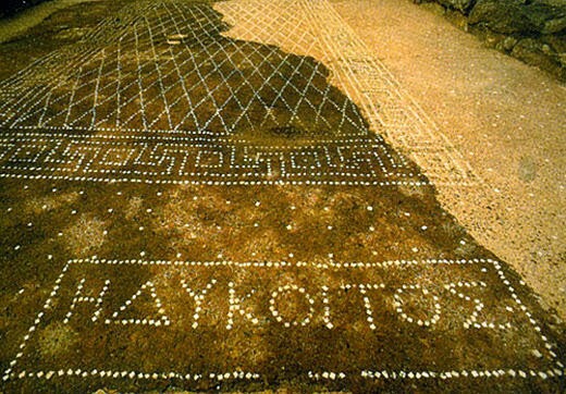
Mosaic with Greek inscription
Description
The site of Empuries in Catalonia contains the remains of an ancient Greco-Roman city and military camp and is one of the oldest of its kind found on the Iberian Peninsula.
The history of Empuries dates back to the early Iron Age, but the remains that can be seen today at the Empuries archaeological site are those of both a Greek trading port and a Roman military camp.
Founded in the sixth century BC by ancient Greek traders from Phocaea, Emporion – as it was originally known – was used by Greek merchants who utilised the advantageous location of its valuable natural harbour. The very name of the city implied its commercial purpose – empurion meaning ‘market’ in ancient Greek.
In 218 BC the Romans took control of Empuries in an attempt to block Carthaginian troops during the Second Punic War. By 195 BC a Roman military camp had been established and over the next century a Roman colony named Emporiae emerged at the site, lasting until the end of the third century AD. However, over time the city waned as the nearby centres of Barcino (Barcelona) and Tarraco (Tarragona) grew. The importance of Empuries dwindled and the city was largely abandoned at this time.
In the eighth century AD the Franks took control of the region, after defeating the Moors, and the area took on an administrative function – becoming capital of the Carolingian county of Empúries. This role remained until the eleventh century, when it was transferred to Castellon. From then on Empuries served as the home of small groups of local fisherman and was largely forgotten.
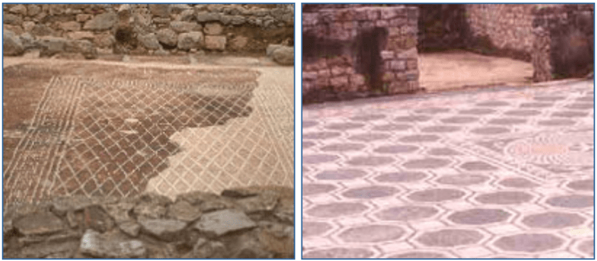
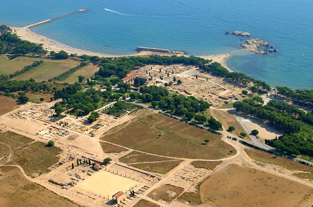
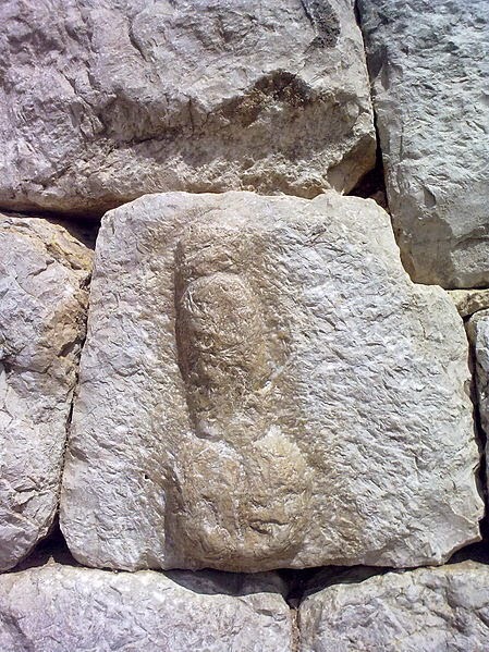
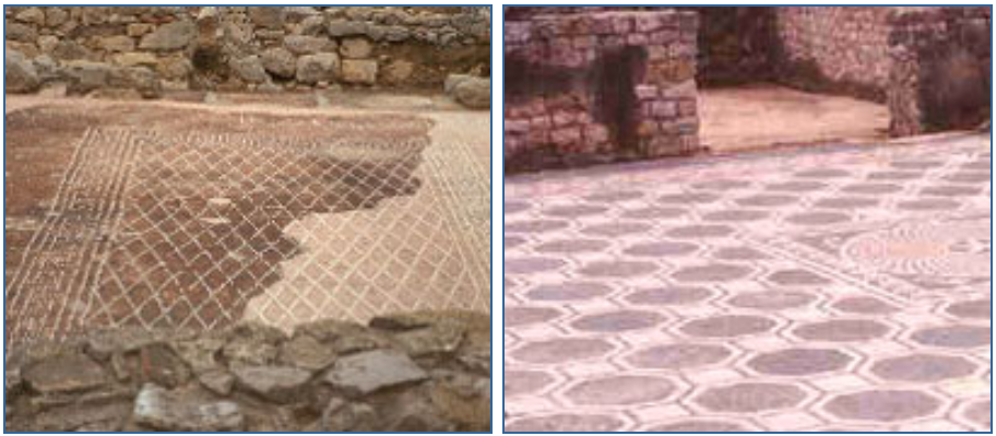
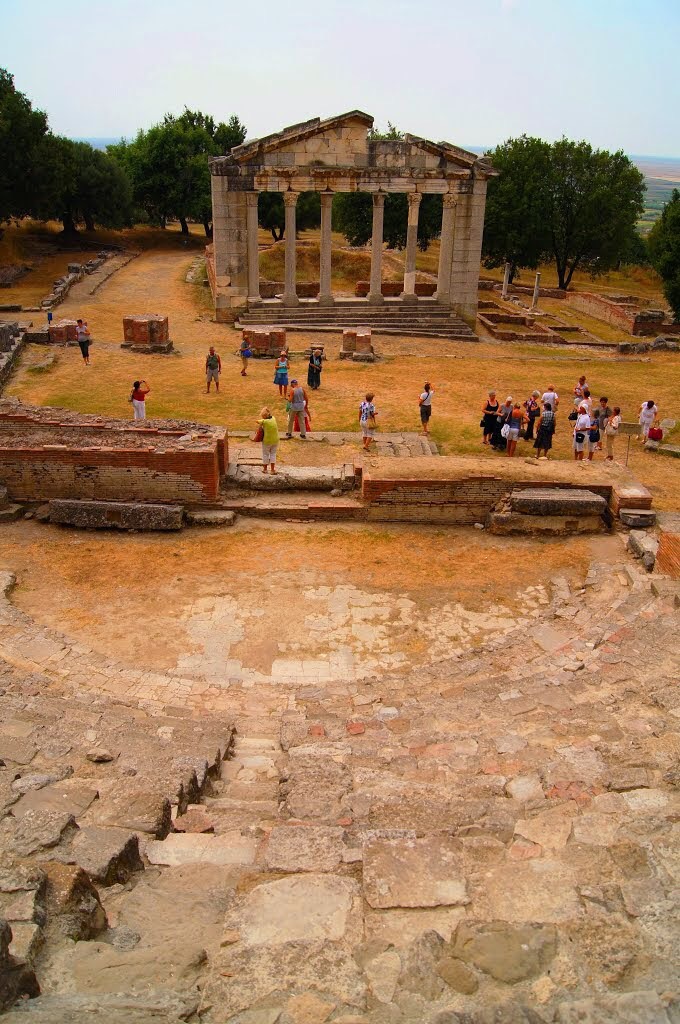
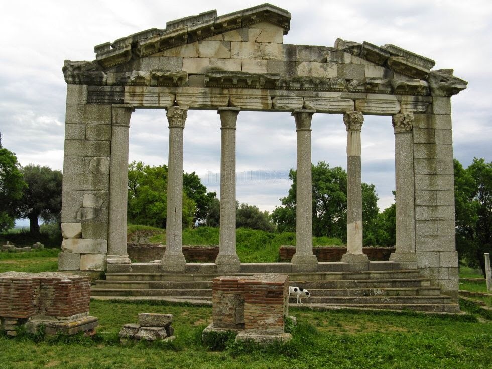
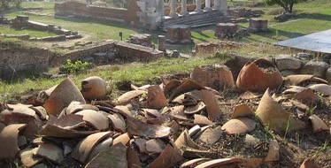
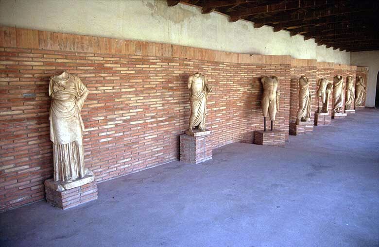
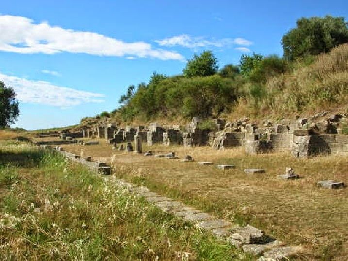
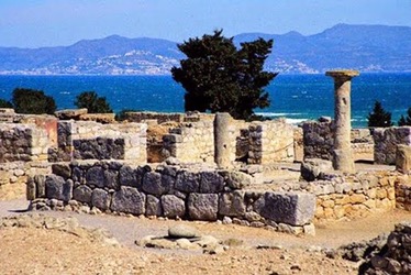
The enclosure of the Greek town has been completely excavated. To the S is a temple area (Asklepieion and temple of Serapis), a small agora, and a stoa dating from the Roman Republican period. It is surrounded by a cyclopean wall breached by a single gate, confirming Livy’s description. On top of the Greek town and further inland is a Roman town, ten times larger and surrounded by a wall built no earlier than the time of Augustus. Inside is a forum, completely leveled, on which stood small votive chapels. To the E, facing the sea, are two large Hellenistic houses with cryptoportici, which contained remains of wall paintings and geometric mosaics. Many architectural remains are in the Barcelona Archaeological Museum and in the museum on the site. Among the finds are a statue of Asklepios, a Greek original; the mosaic of Iphigeneia, an archaic architectural relief with representations of sphinxes; Greek pottery (archaic Rhodian, Cypriot, and Ionian; 6th-4th c. Attic, Italic, and Roman). Several cemeteries near the town have also been excavated.
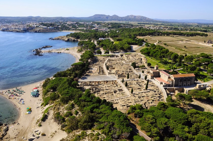
Today, the archaeological site of Empuries is nestled between the coastal village of Sant Marti d’Empuries and l’Escala, on the Costa Brava. Remains at the site include the ruins of the Greek market and port, an ancient necropolis as well as the Roman-era walls, mosaics, amphitheatre and early Christian basilica.
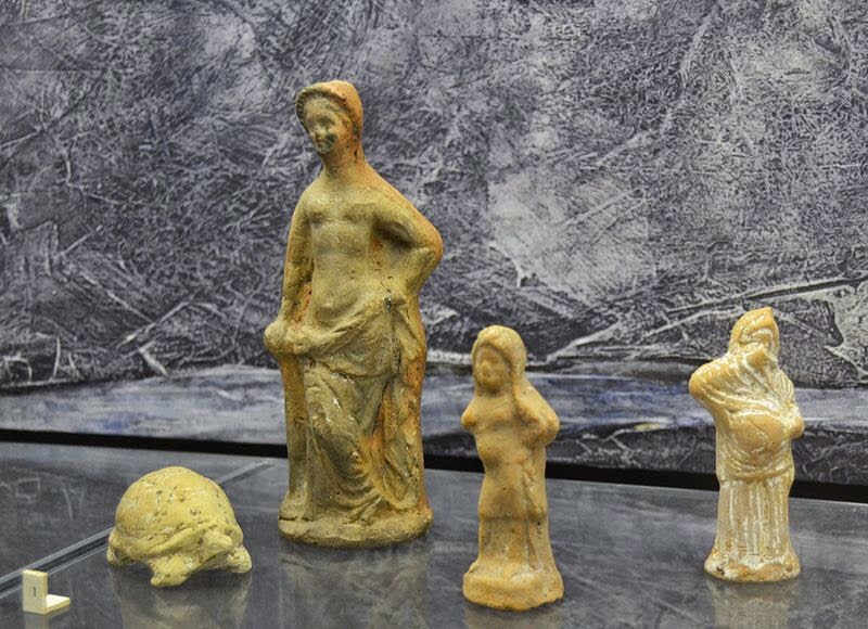
The ruins illustrate the rich and diverse history of the city, from holy areas and temples to a statue honouring Jupiter. Many of the finds from Empuries can be seen in the small on-site museum, which contains replicas as well as original items. Artefacts from the site can also be found at the central museum in Barcelona.
The site’s location on the Balearic Sea boasts magnificent views, making it a perfect location to explore history in scenic surroundings.
Empuries is managed by the Museu d’Arqueologia de Catalunya, which looks after other historic sites nearby and on the peninsula.
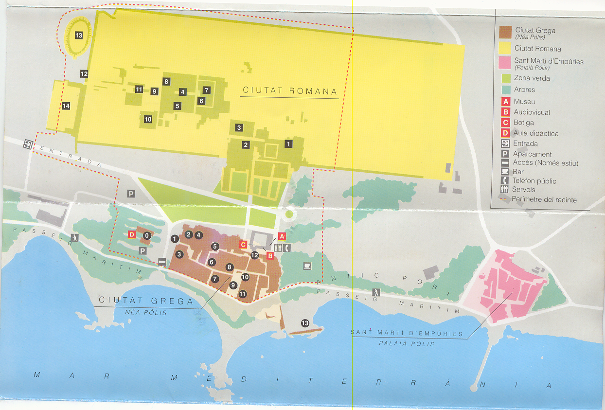
Site Monuments
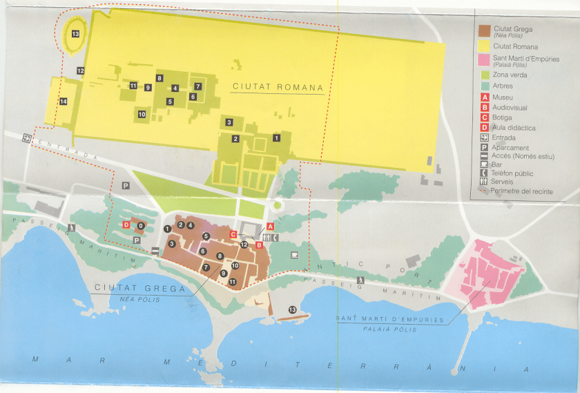
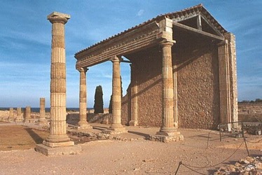
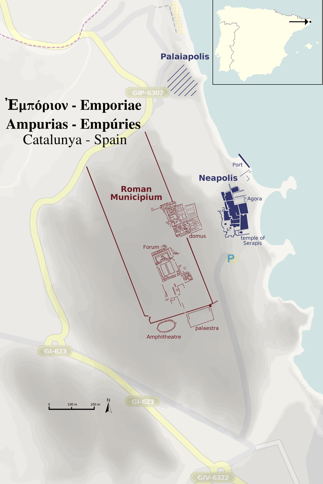
The Palaiapolis
The island on which the Palaiopolis was situated is now part of the mainland and is the site of the mediaeval village of Sant Martí d’Empúries. The former harbour has silted up as well. Hardly any excavation has been done here.
After the founding of the Neapolis, the old city seems to have functioned as an acropolis (fortress and temple). Strabo mentions a temple dedicated to Artemis at this site.
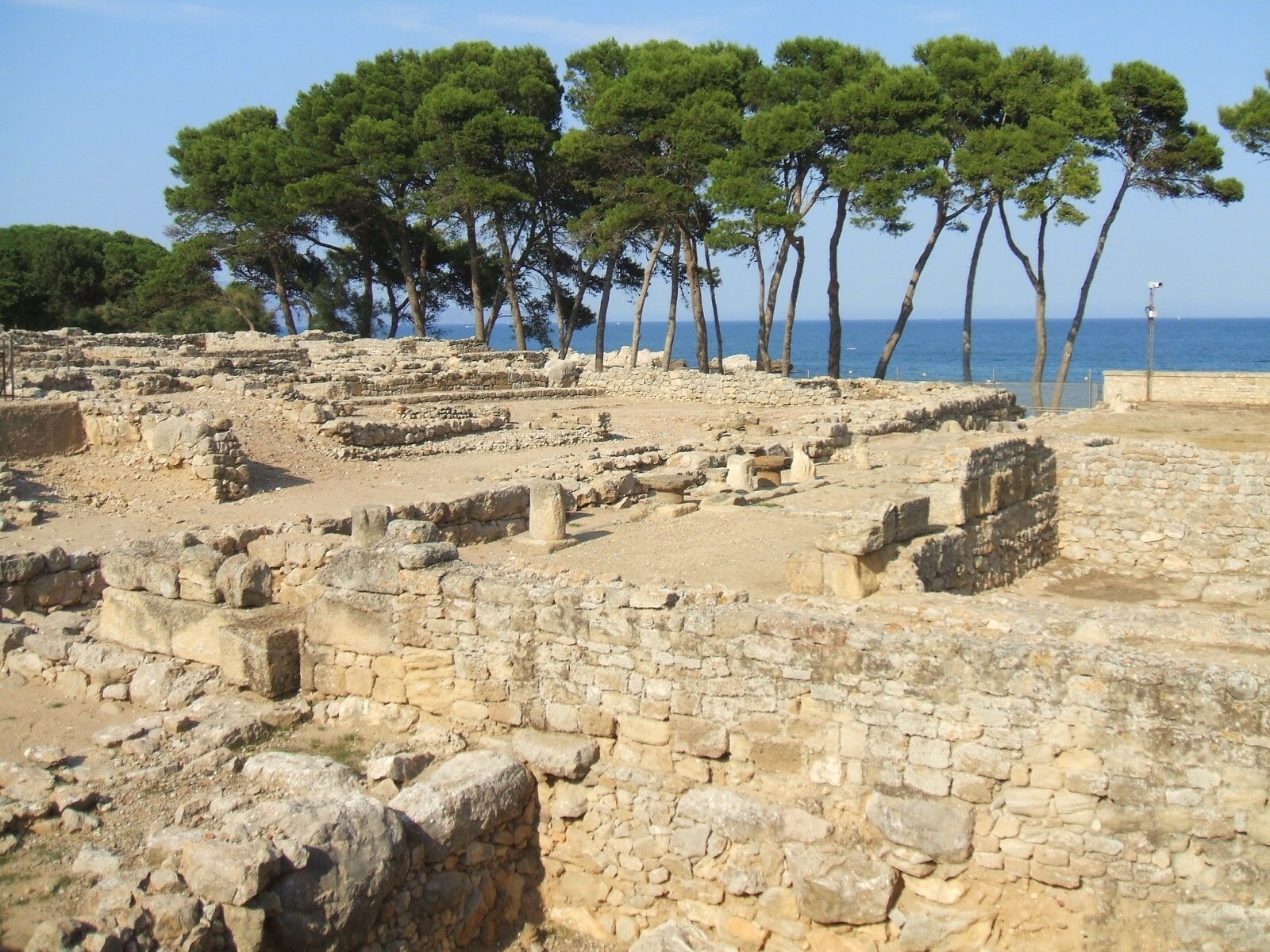
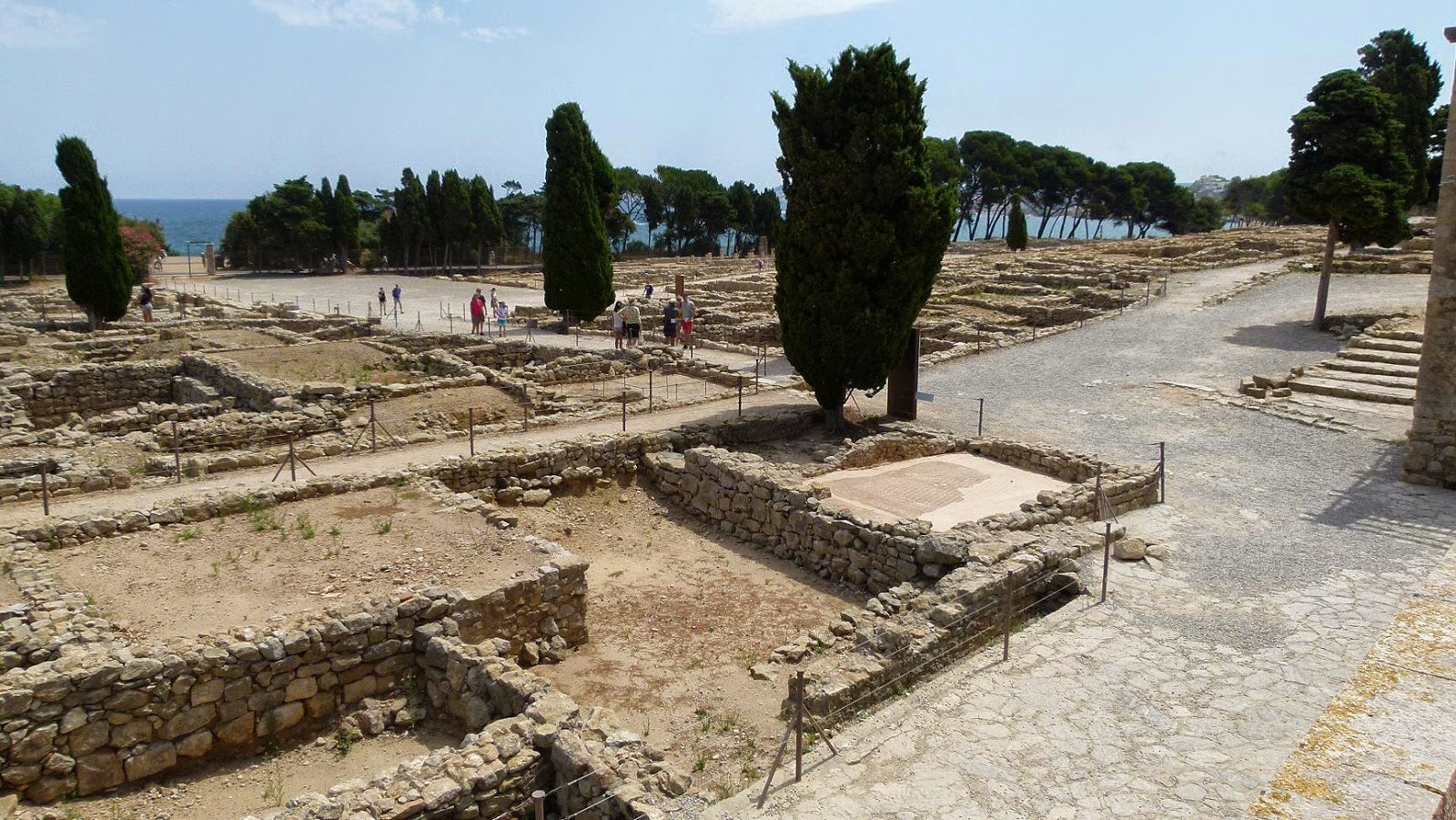
The Neapolis
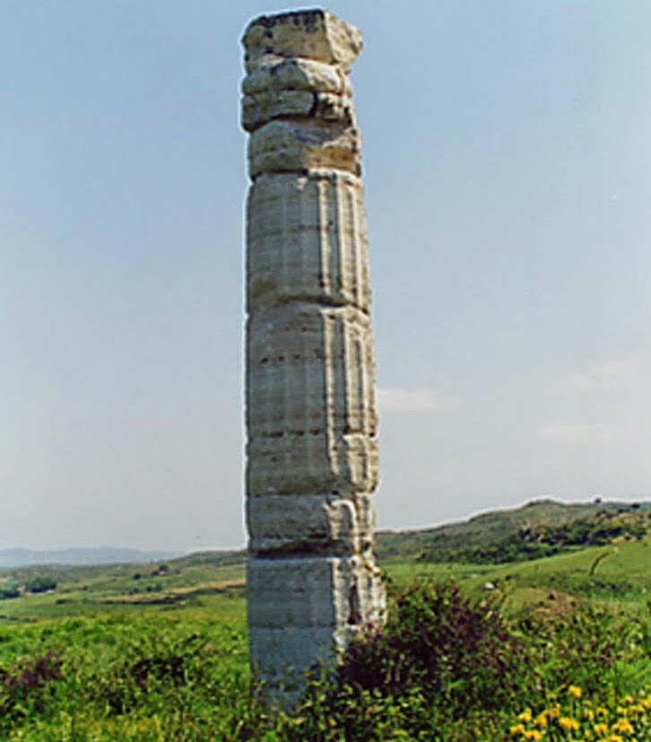
The Neapolis consisted of a walled precinct with an irregular ground plan of 200 by 130 m. The walls were built, and repeatedly modified in the period from the 5th to the 2nd century BC. To the west the wall separated the Neapolis from the Iberian town of Indika.
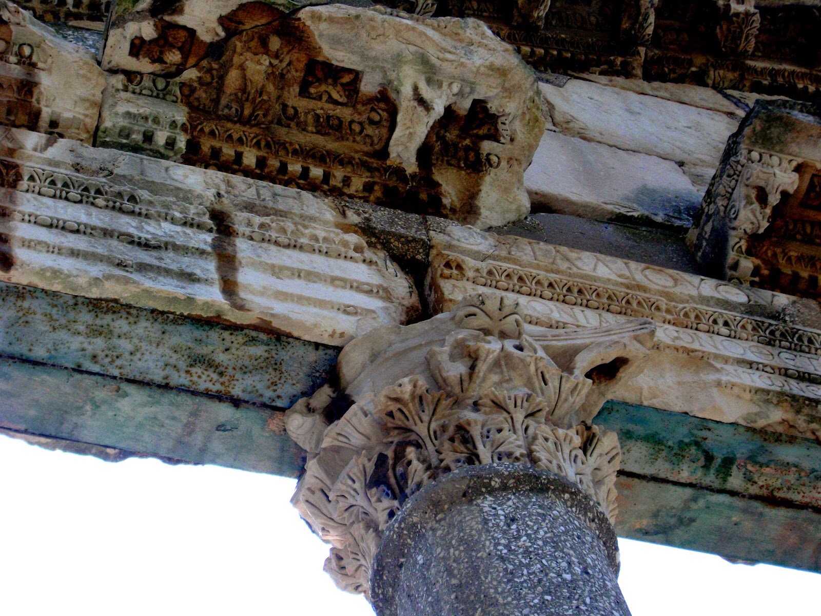
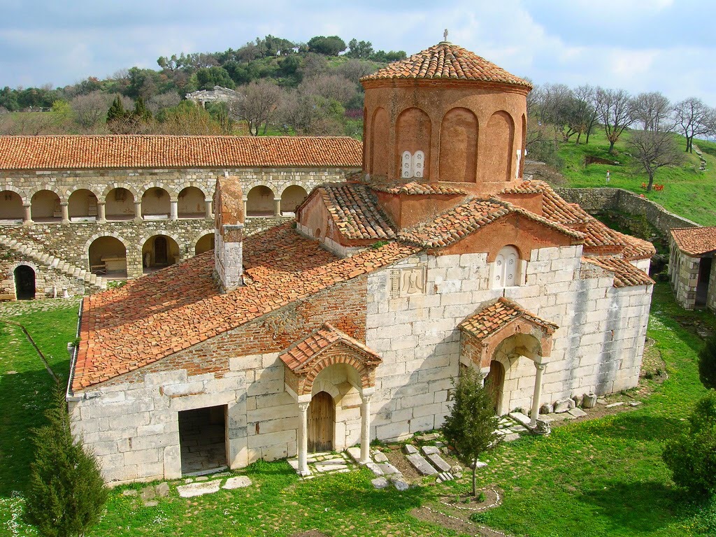
In the south-west part of the city were various temples, replacing an older one to Artemis, such as a temple to Asclepius, of whom a marble statue was found. In the south-east part was a temple to Zeus-Serapis. The majority of the excavated buildings belong to the Hellenistic period. In addition to houses, some of which are decorated with mosaics and wallpaintings, a number of public buildings have come to light, such as those in the agora and the harbour mole. In the Roman period, thermae and a palaeochristian basilica were built.
To the south and east of the new city was an area that served as a necropolis.
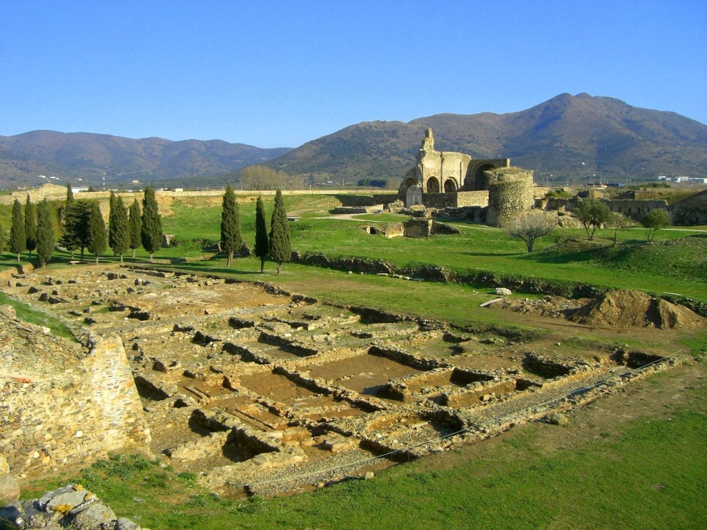
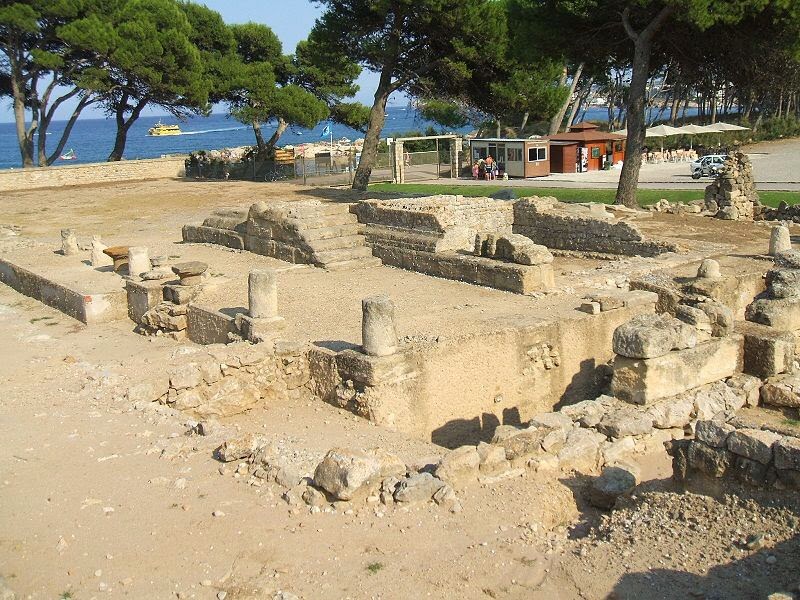
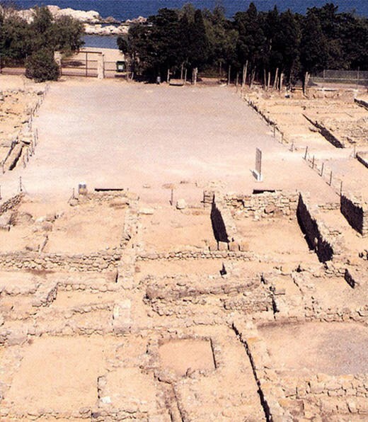
The Roman city
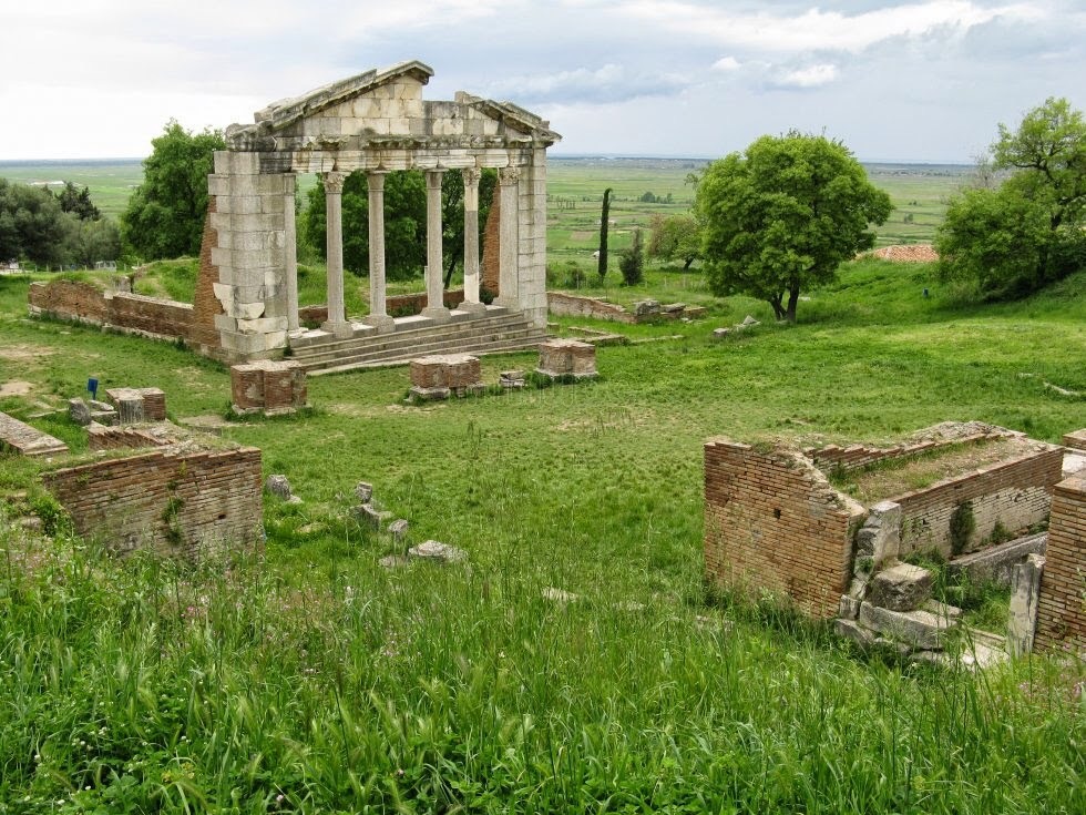
Of the Roman city only some 20% has been excavated thus far. It has the typical orthogonal layout of Roman military camps, with two principal roads meeting at the forum. The Roman city is considerably larger than the Greek one. During the Republican period a temple was built dedicated to the Capitoline Triad: Jupiter, Juno, and Minerva. During the reign of the emperor Augustus a basilica and curia were added.
In the eastern part of the town a number of large houses have been excavated, with an inner courtyard, numerous annexes, floor mosaics, and paintings. In the 2nd century the town was surrounded by a wall without towers. An amphitheatre and palaestra were built outside the wall.
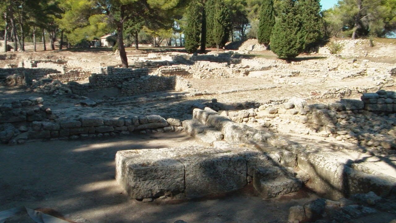
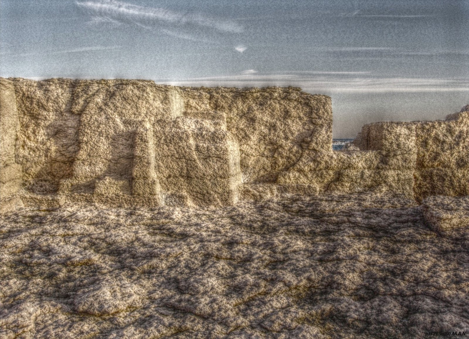
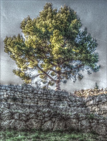
Ruins of Neapolis and Palaiapolis

Serapieion (Temple of Isis and Zeus Serapis)

Agora

Stoa (agora)
Greek mosaics